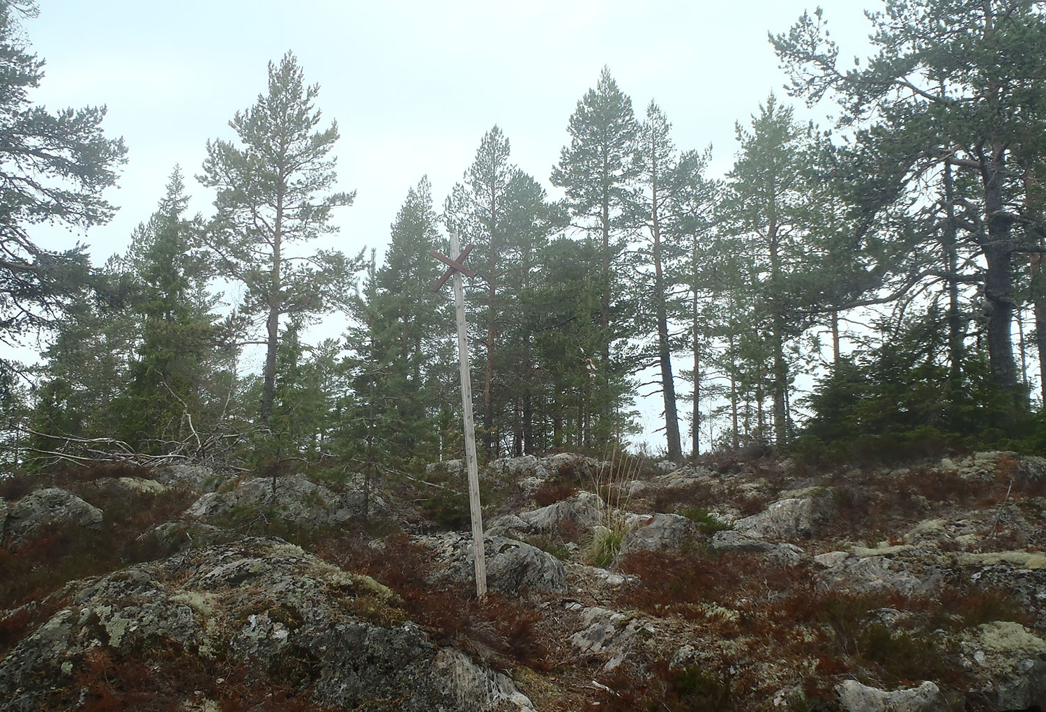
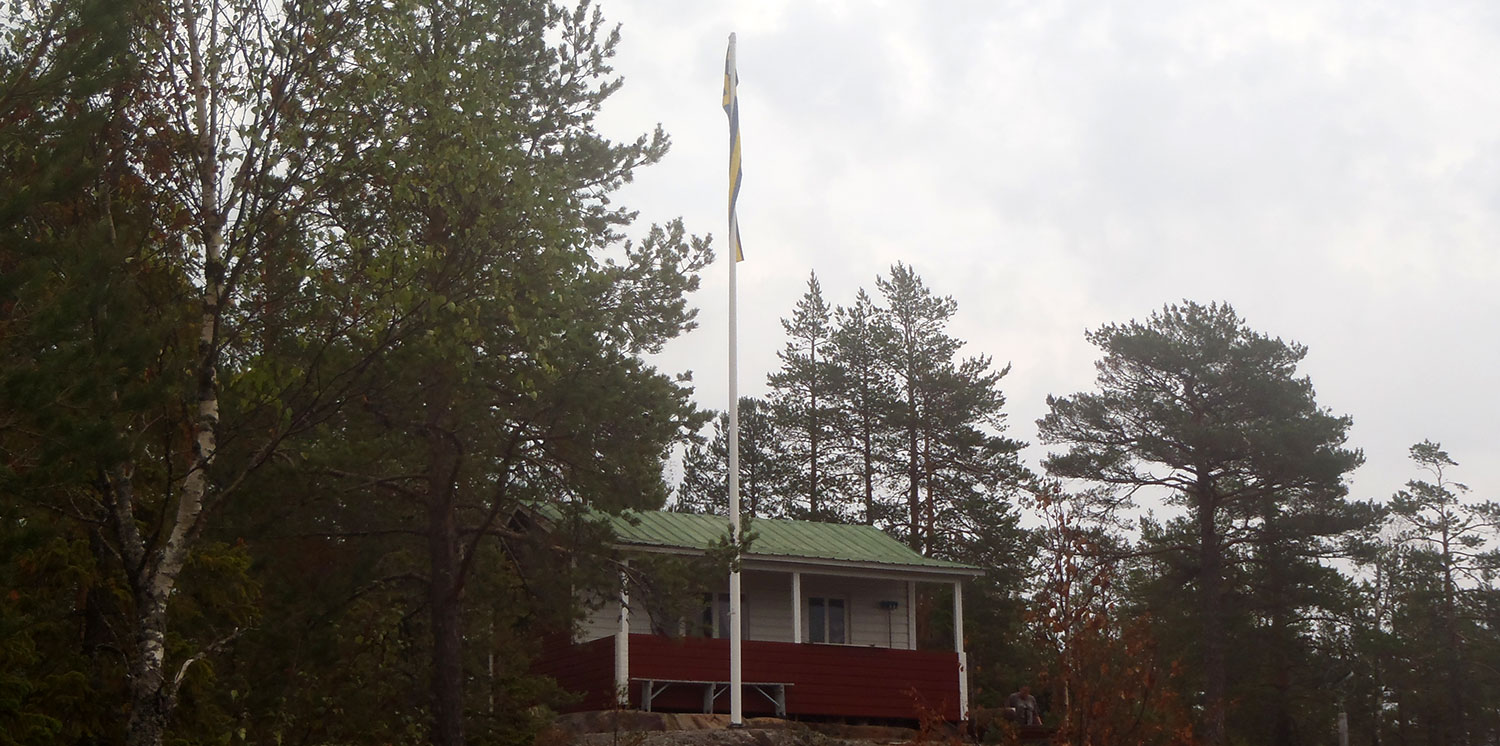
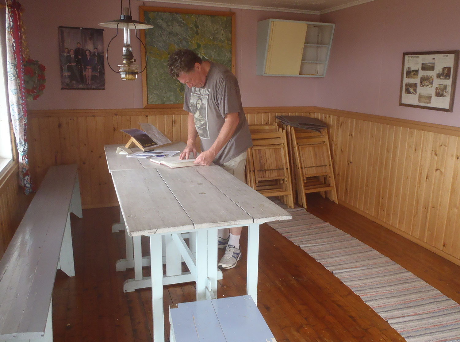
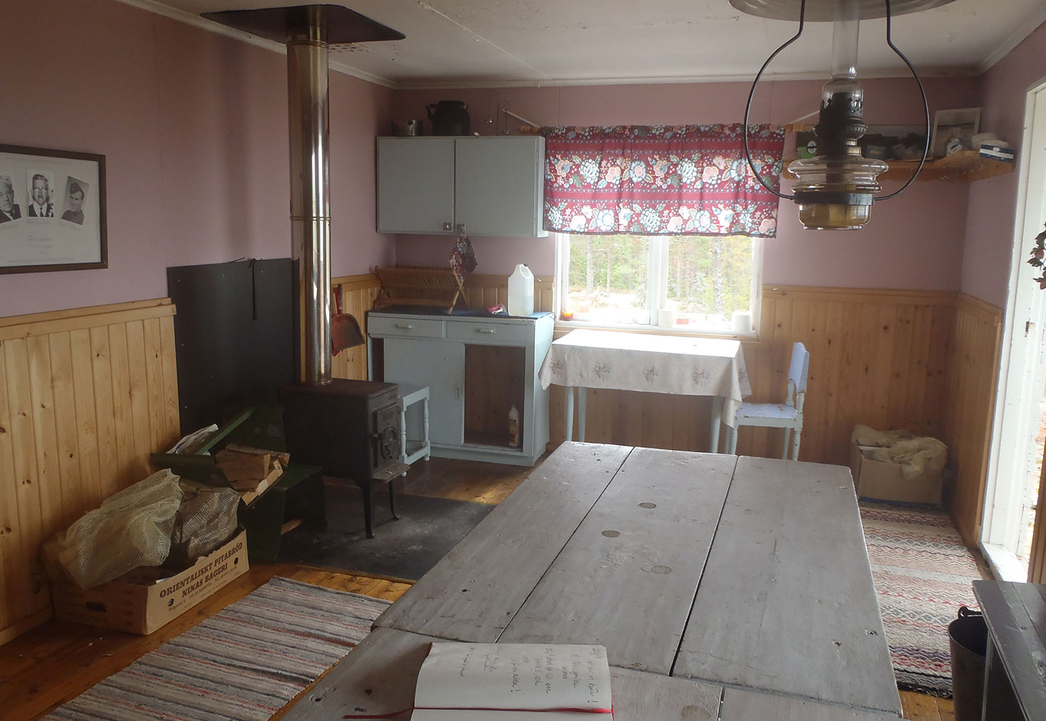
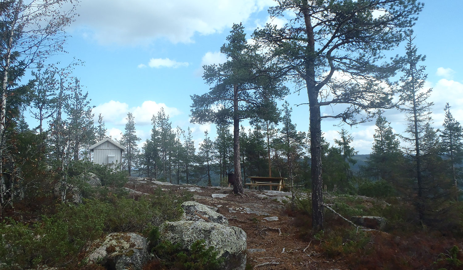
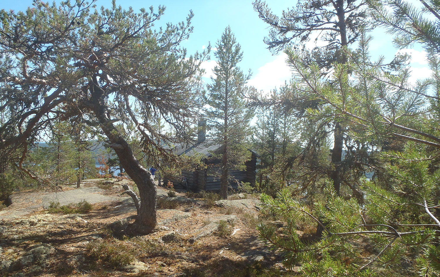
Vandringstips IV: Gårdsberget i Gallsäter var lagom denna gråa mulna dag. Inte särskilt långt att gå, inte särskilt brant. Men en riktigt fin stuga och en helt ok utsikt. Vi hann precis ner från berget igen innan det började regna.
Hiking Tips IV: Mt. Gårdsberget in Gallsäter was just perfect this gray cloudy day. Not very far to walk, not very steep. But a really nice cabin and an absolutely ok view. We just got down from the mountain again before it started to rain.
Vi följde skoterspåret. We followed the snowmobile trail.Liten röd stuga. Little red cabin.Stugans framsida. The front of the cabin.Insidan. The inside.Insidan 2. The inside 2.Fina faciliteter. Fine facilities.OK utsikt. OK view.Mer utsikt. More view.Härifrån tittade vi på utsikten. This is from where we looked at the view.
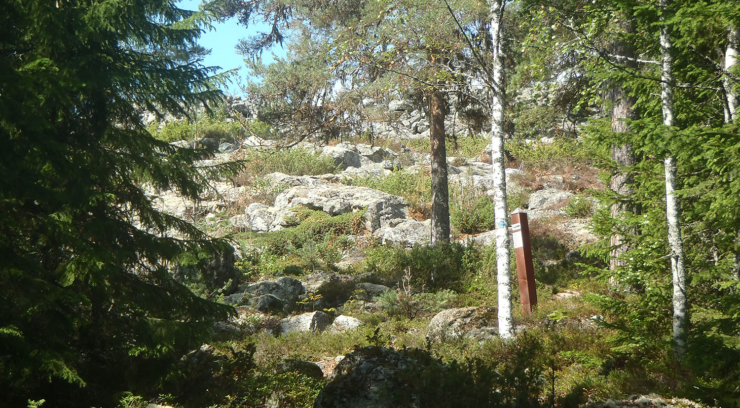
Borgberget med Stensättersborgen ligger inte på vandringstipslistan, men eftersom vi var i närheten ville vi titta även på det. Det ångrar vi inte ett ögonblick! En ganska brant väg upp, men vilket mäktigt ställe!
Borgberget är en klippformation som stupar ca 200 m på tre sidor. Stensättersborgens mur är ca 3 m tjock och 200 m lång. Utanför muren finns lämningar som kan ha varit ytterligare en murlinje och även en gravlämning. Borgen tros ha byggts under folkvandringstiden, ca 400–800 EVT.
Mt. Borgberget with the Stensätter fortress is not on the hiking list, but since we were nearby we wanted to have a look at it. We don’t regret that for a moment! A rather steep trail up, but what a mighty place! Borgberget is a rock formation where three sides are precipices of about 200 m. The stone wall of the Stensätter fortress is about 3 m thick and 200 m long. Outside the wall there are remains that could have been a further wall line and also remains of a grave. The fortress is believed to have been built during the time of the Great Migration, about 400–800 AD.
Om Borgberget. Startplatsen har flera skyltar med mycket information. About Mt. Borgberget. The starting point has many signs and lots of information.Ytterligare information på vägen upp. Even more information on the way up.Den stora muren! The great wall!Nära öppningen. Close to the entrance.Muren från sidan. The wall from the side.Muren från ovansidan. The wall from the top-side.Utsikt ”inifrån borgen”. View from ”inside the fortress”.Runt och bakom berget finns mest skog men även ett gammalt stenbrott. Around and behind the mountain there is mostly forest, but also an old quarry.En vilostund innan vi går ner igen. A breather before we go down again.En idé om hur det kan ha sett ut – från en av skyltarna vid stigens början. An idea of how it might have looked – from one of the signs at the beginning of the trail.
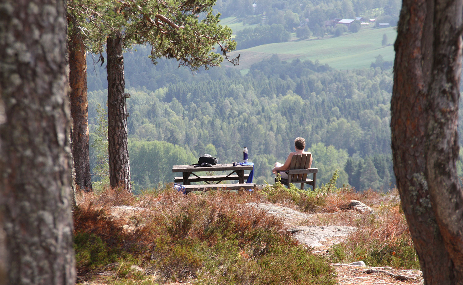
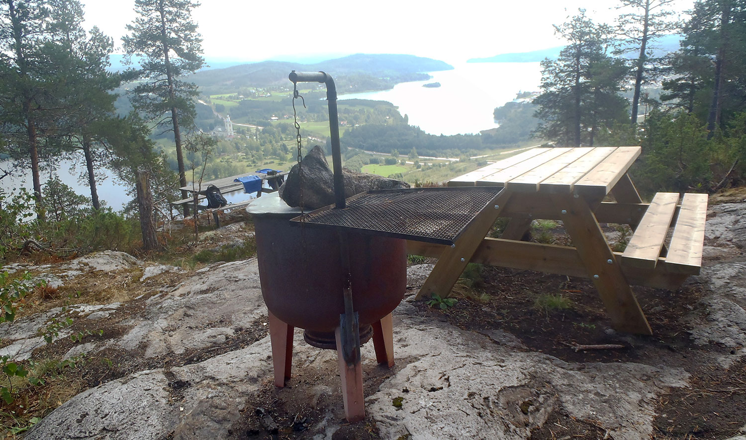
Vandringstips III: Svedjeberget i Bollstabruk blev nästa berg på vandringstips-listan att bestiga. En behaglig promenad upp på berget och även här en hänförande utsikt, men nu mer inlandsmässigt. Fast så klart finns ändå kopplingen till havet även på Svedjeberget!
Hiking Tips III: The Svedjeberget mountain in Bollstabruk was the next mountain on the hiking tips list to climb. A pleasant walk up the mountain and here too a breathtaking view, but now more inland. But of course there is a connection to the sea even from Svedjeberget!
Startpunkten. The starting point.Vi vet att vi är på rätt väg. We know we are on the right track.Där är utsiktspunkten. There is the viewpoint.Välordnat med både bord och grill. Men i år grillar vi inte. Well-arranged with both tables and a BBQ-grill. But no BBQing this year.Det finns t o m ved att tillgå. Fast i år behövs som sagt inte den. There’s even firewood. But as said, this year that is not necessary.Vi tittar på utsikten över Ytterlännas kyrka i stället. We look at the view of the Ytterlännäs church instead.
Vandringstips II: Vi valde att ge oss på Fäberget mellan Docksta och Ullånger denna vackra dag. Efter lite problem med att hitta stigen upp på berget (”entrén” var massakrerad av en ny väg orsakad av skogsmaskiner) kom vi till sist rätt. Via ett kalhygge gick stigen raka vägen upp på berget, en inte särskilt påfrestande vandring. Vi möttes av en otrolig utsikt!
Hiking Tips II: We chose to give Fäberget between Docksta and Ullånger a try this beautiful day. After a little trouble finding the track up to the mountain (”the entrance” was massacred by a new road caused by forest machines) we finally got it right. Through a clear-felled area the track went straight up to the mountain, not a very demanding walk. We were met by an incredible view!
Vi har hittat leden. We have found the track.Sigge hittade några tyska vandrare som han kunde prata tyska med. Sigge found a couple of German hikers he could speak German to.Efter kalhygget kom en skön skog och en ganska brant stigning. After the clear-cutting came a nice forest and a rather steep climb.Vi närmar oss toppen. We are getting close to the mountain top.Första utsikten. The first view.Raststugan! The cabin!Havet! Och därborta Ulvön. The sea! And over there the Ulvön islands.Vi fick vårt kaffe i en helt underbar miljö. We had our coffee in an absolutely wonderful environment.Sedan gick vi ned igen. Then we went down again.
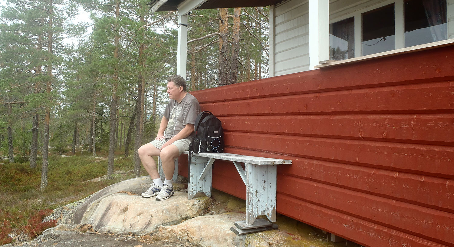
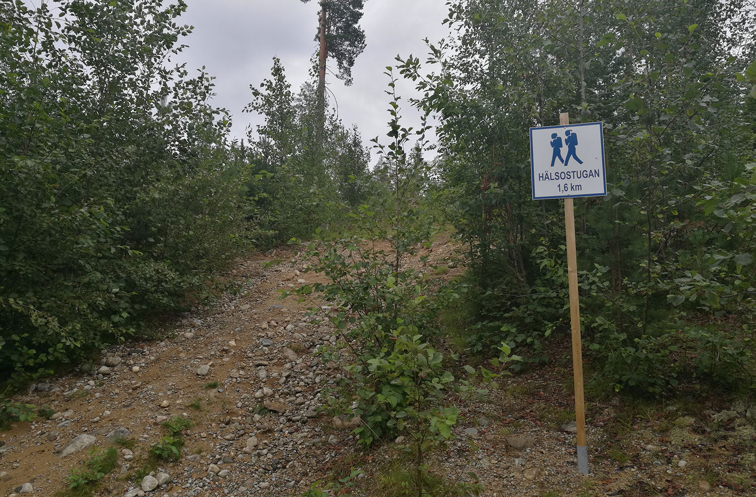
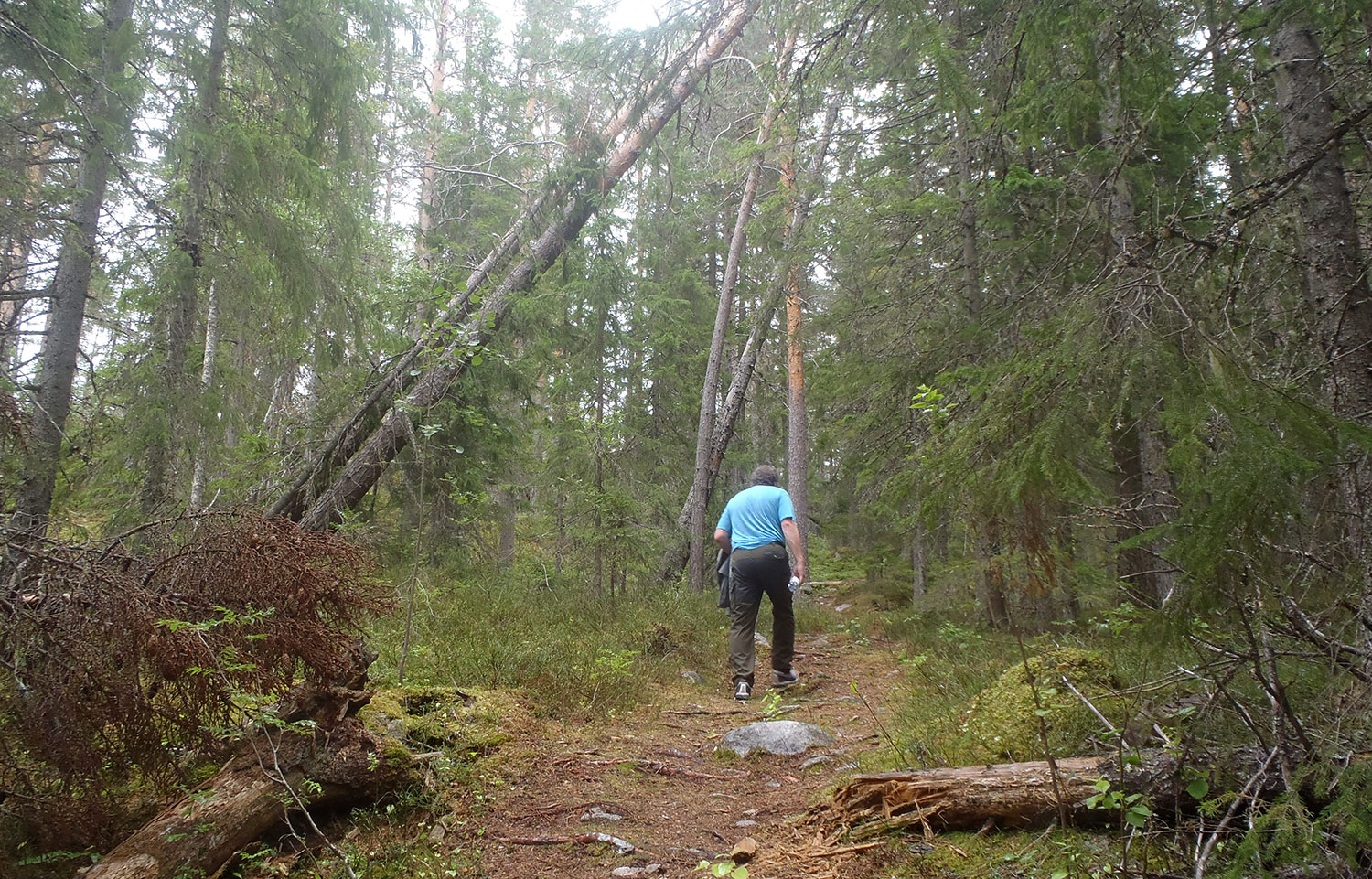
Vandringstipset är en satsning av kommunen och dess orienteringsklubbar för att få Kramforsborna att ge sig ut i skogen lite mer. Man får tips på ett antal mål för sin vandring och vi tänkte vi skulle prova några av dem. Denna regniga dag började vi med Hälsostugan på Latberget, nära själva Kramfors. Det var en alldeles lagom promenad, inte särskilt brant, men ändå med en riktigt fin utsikt över staden vid stugan. Detta är ett ställe vi kommer att besöka igen, förhoppningsvis i lite bättre väder!
”Hiking tips” is a campaign launched by the municipality and its orienteering clubs to get the citizens of Kramfors to get out into the forests a little more. You get tips on a number of hiking goals and we thought we would try some of them. This rainy day we started with Hälsostugan (”the Health cabin”) at Mt. Latberget, near Kramfors itself. It was quite a perfect walk, not very steep, yet with a really nice view of the city from the cabin. This is a place we will visit again, hopefully in some better weather!
Starten på leden. The beginning of the trail.Uppför berget. Up the hill.Där är stugan! There is the cabin!Byggd 2007, riktigt fin. Built in 2007, really nice.Kramfors vid våra fötter. Kramfors at our feet.En närmare titt. A closer view.På långt avstånd: bron över Björknässundet. At a long distance: the bridge over the Björknäs inlet.
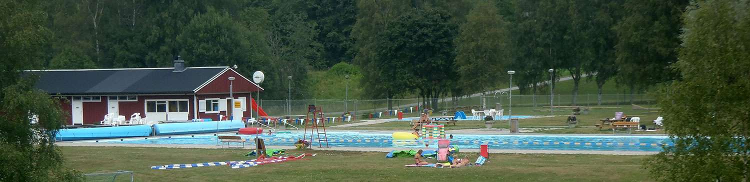
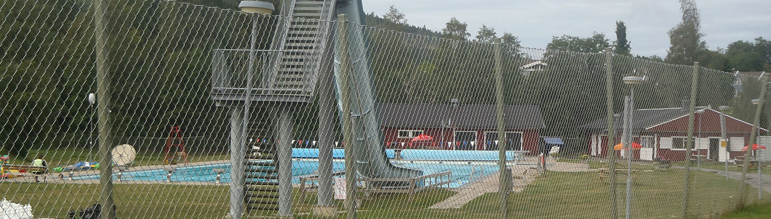
Vi har haft den varmaste, soligaste sommaren – och ändå står stadens allmänna bad nästan tomt. Bilderna nedan är tagna olika datum, men inte någon gång har det varit mycket folk där. Vad kan det bero på?
We have had the hottest, sunniest summer – yet the town’s public swimming pool is almost empty. The pictures below are taken different dates, but not once there have been a lot of people there. What could the reason be?
Några få besökare. A few visitors.Några fler besökare. A few more visitors.En ensam badvakt (till vänster). Det är allt. One single watch-out (to the left). That’s all.Kan detta vara förklaringen? Är det för dyrt? Varför inte införa värmerabatt? Could this be the explanation? Is it too expensive? Why not introduce heat discount?
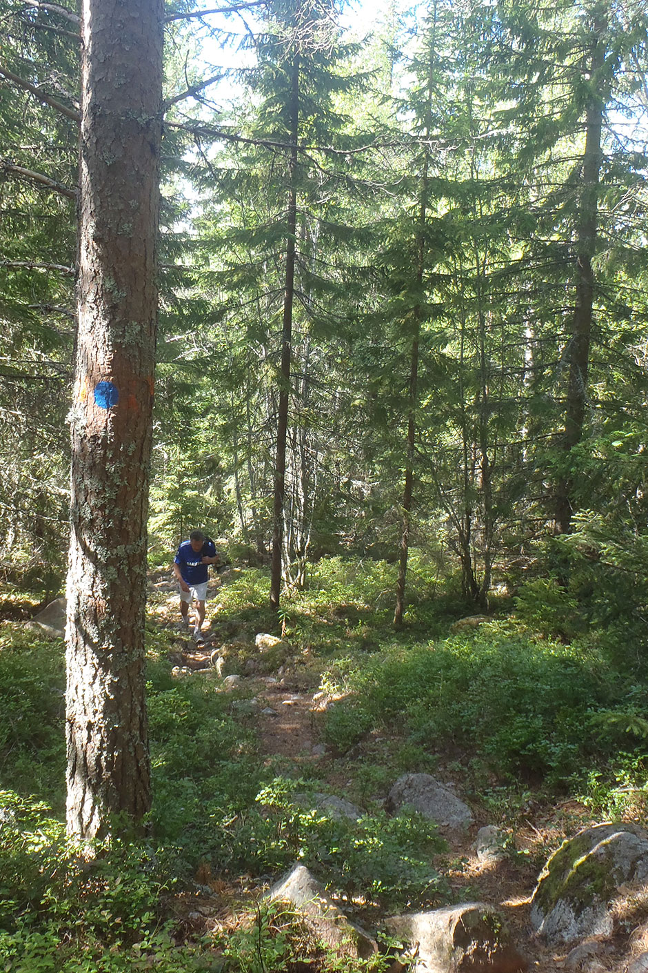
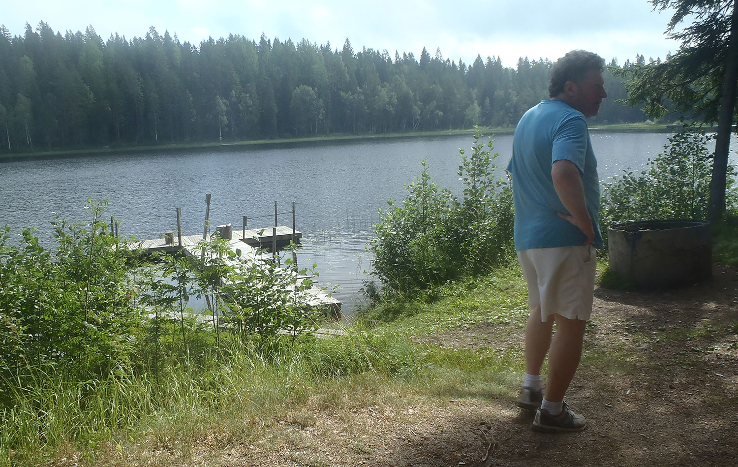
Vi vill motionera lite och tänkte vi skulle gå runt Icktjärn. Det är en fantastiskt väl hållen liten sjö med spänger att gå på, grillplatser, bryggor o s v. Men när vi kom ut i terrängen var det så blött efter skyfallet att vi gav upp och for upp på ”vårt” berg vid Storvattnet istället. Vi hittade dock inga kantareller.
We want to exercise a little and thought we would walk around Icktjärn. It’s a very well-kept little lake with footbridges to walk on, barbecue places, bridges, etc. But when we got out into the terrain it was so wet after the rain that we gave up and went up on ”our” mountain at lake Storvattnet instead. We did not find any chanterelles, though.
Det började bra i den gröna naturen. It all started well in the green nature.Ett av de ställen man kan grilla på. One of the spots where you can barbecue.Samma grillplats. Same barbecue spot.Vyn från berget över Storvattnet. The view from the mountain over the lake Storvattnet.
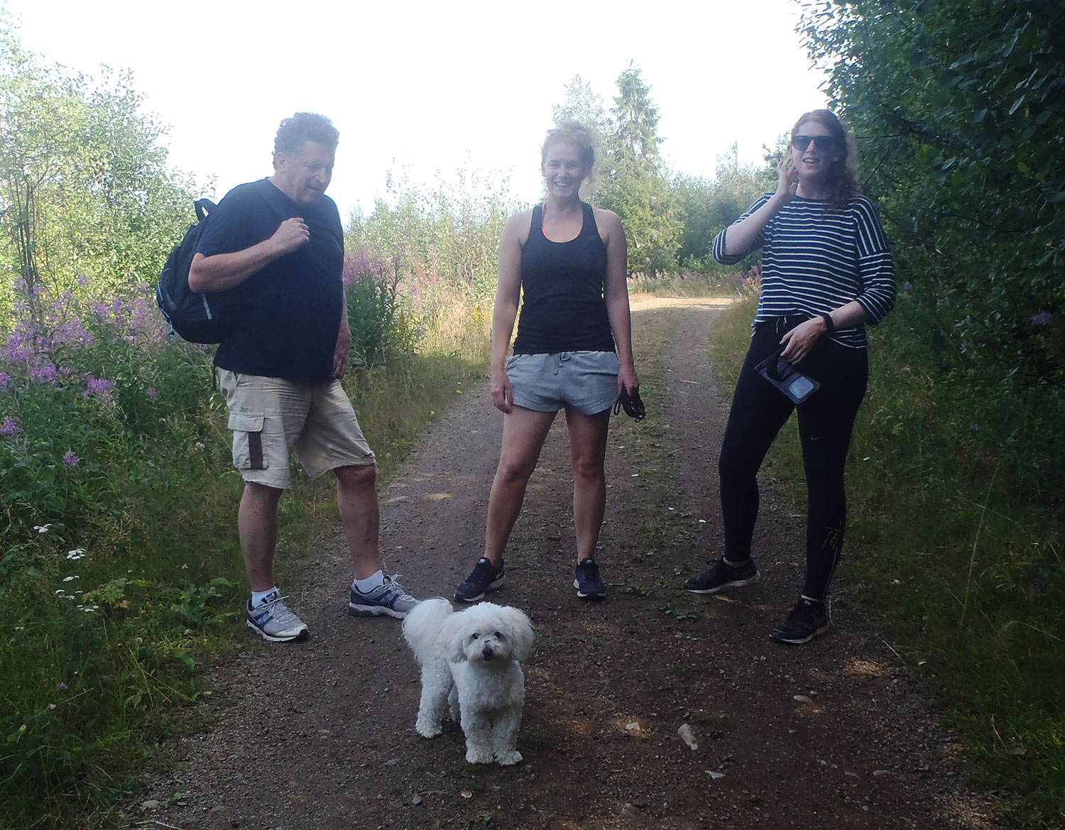
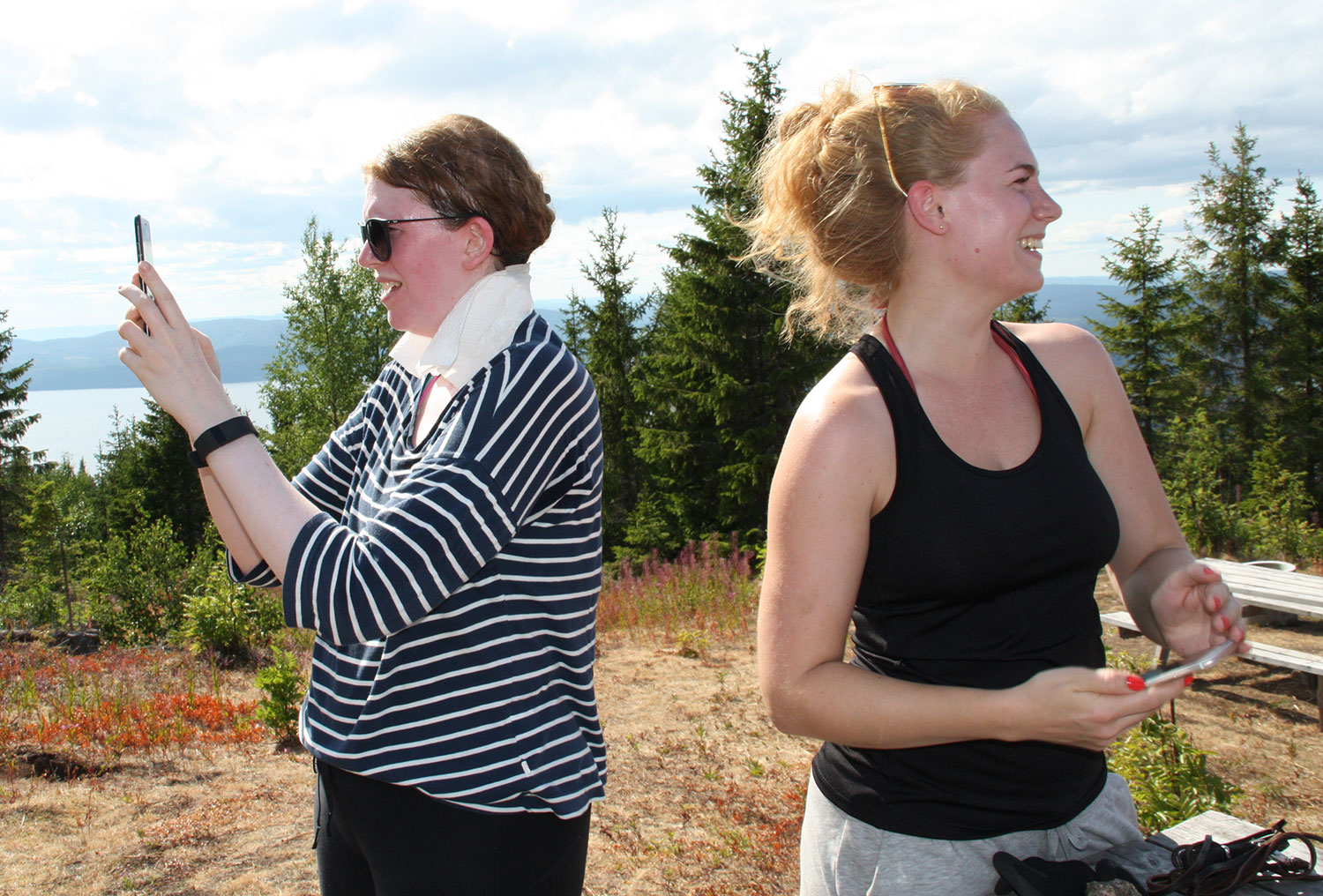
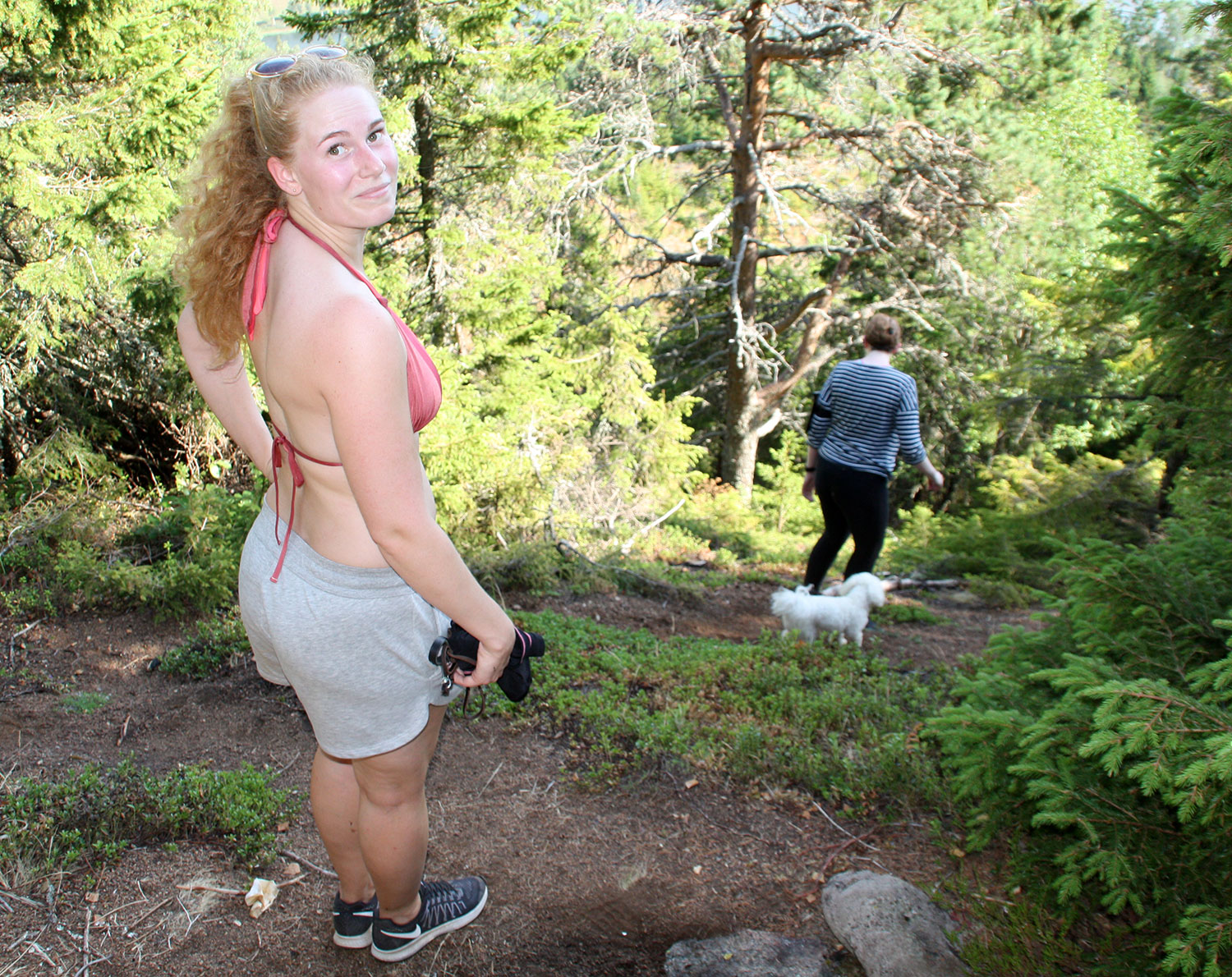
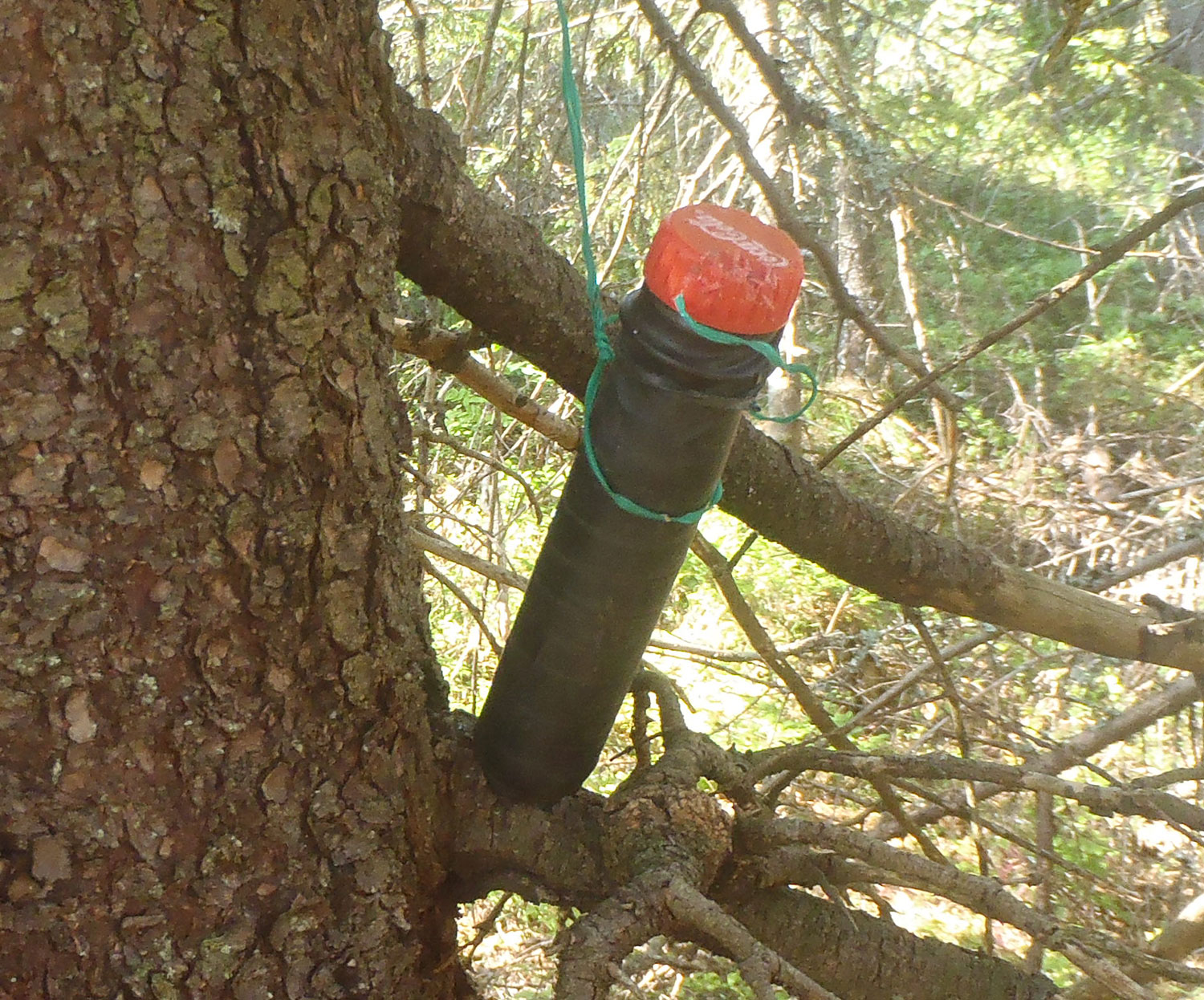
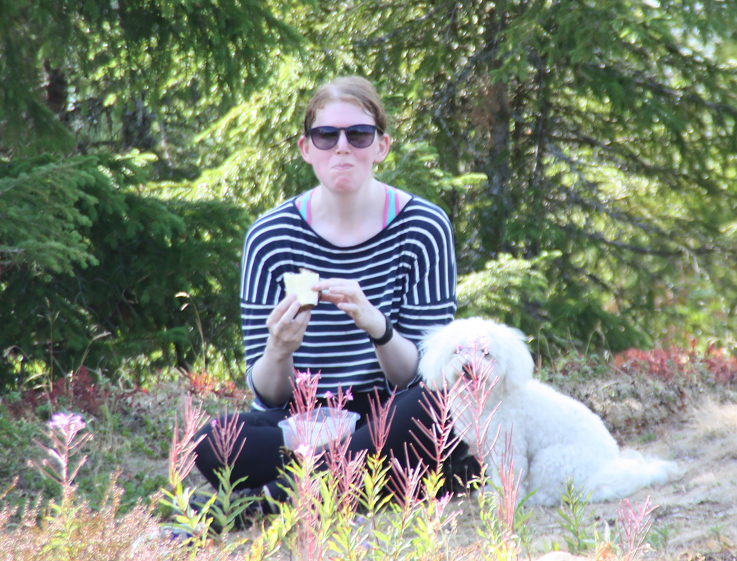
Kristin, Antonia och lilla hunden Evert kom på besök. Vi behövde alla röra på oss lite, så det blev en tur upp på berget Ringkallen. Det verkar som om vi ska gå dit vartannat år. Det är en ganska svettig promenad även om den sker på riktig väg. Det är ganska brant här och där. Men väl uppe har man en härlig utsikt. Dessutom hittade vi äntligen den där geocachen som vi sökt flera gånger förut – hurra!
Kristin, Antonia and the little dog Evert came to visit. We all needed to move our bodies a bit, so we made a trip up the mountain Ringkallen. It seems as if we are to walk up there every other year. It’s a pretty sweaty walk, even if it’s on a proper track. It is quite steep here and there. But up there is a beautiful view. In addition, we finally found that geocache we searched for several times before – whoopee!
På väg uppför backen. On our way up the hill.Nästan uppe och fantastisk utsikt. Almost up and a fantastic view.Svettig blir man men telefonkameran måste få sitt. You get sweaty but the phone camera must get his.Evert blev också trött och varm. Evert, too, got tired and hot.Dags att spana efter geocachen. Time to look for the geocache.Vi måste gå längre utåt kanten på berget. Kristin först, sedan Evert, sist Antonia. We must go a little bit further out towards the edge of the mountain. First Kristin, then Evert, Antonia last.Där är den! Sigge hittade geocachen. There it is! Sigge found the geocache.Sedan fikade vi. Några ville sitta för sig själva i skuggan. Then we had coffee. Some wanted to sit by themselves in the shadow.Till sist ledsnade vi på denna utsikt… Eventually we got tired of this view……och gick nedåt igen. …and went downwards again.
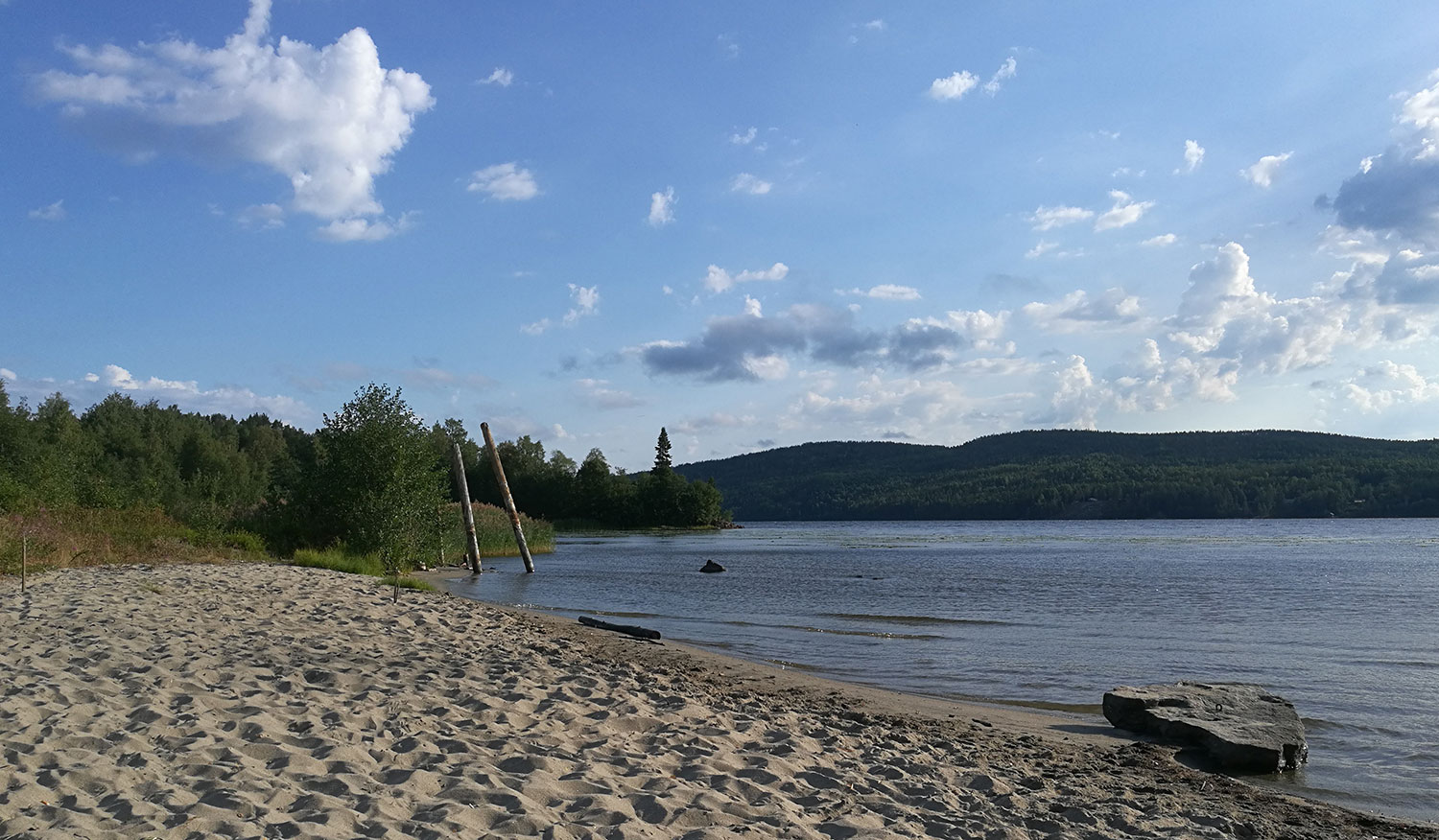
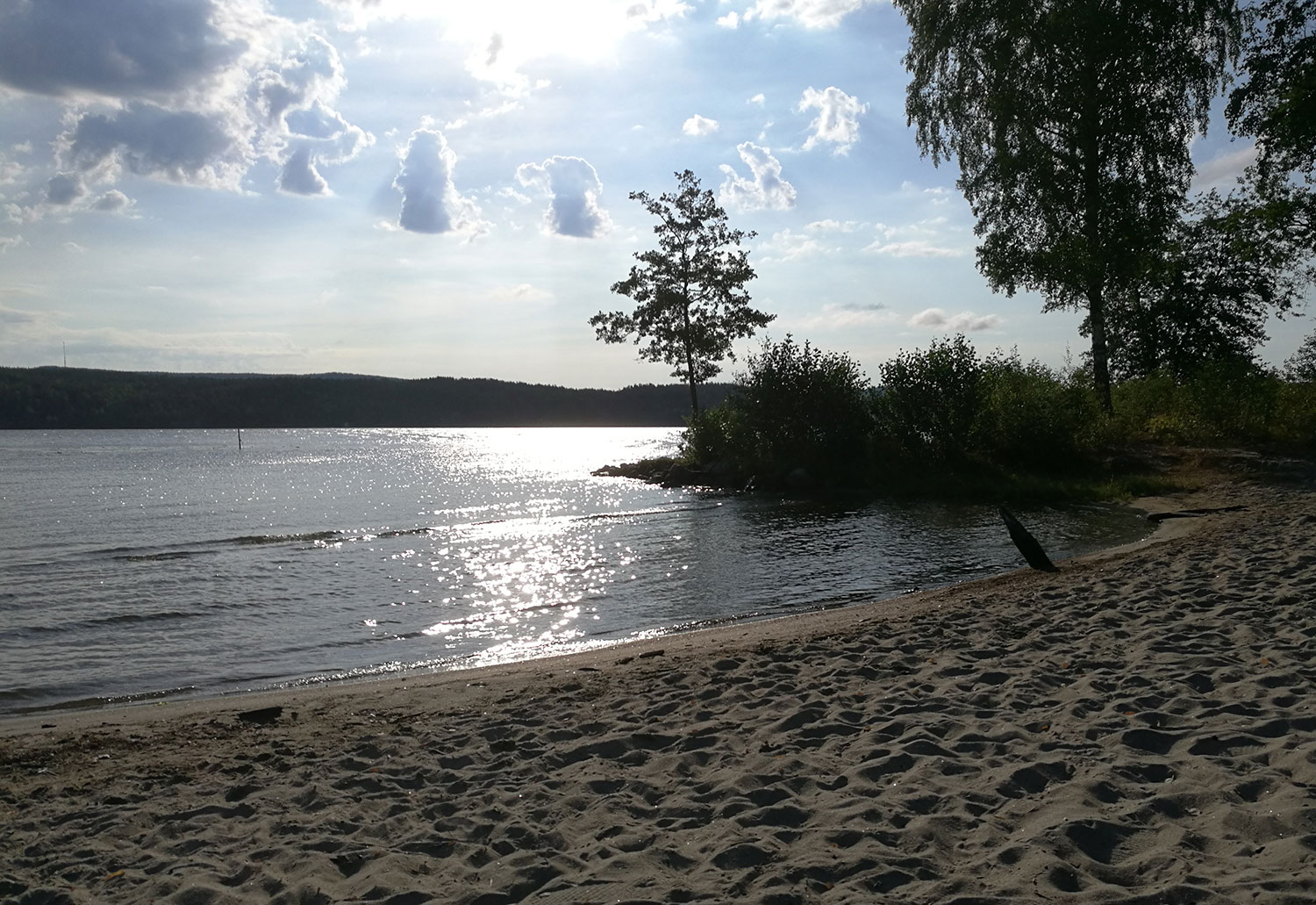
Man behöver inte leta sig ut till havet för att hitta fina sandstränder. I denna lilla stad finns det en fin liten strand på gångavstånd från vårt hus. Där kan man bada i havsvatten, men så här tidigt på morgonen är stranden öde.
You do not have to go out to the sea to find beautiful sandy beaches. In this little town there is a nice little beach within walking distance from our house. There you can swim in sea water, but this early in the morning the beach is deserted.
Vy uppåt viken. View upwards the bay.Vy nedåt viken, mot havet. View downwards the bay, towards the sea.